
Managing flood risk in the Hewitts Creek catchment area
Consultation has concluded

We’re working with community and other stakeholders to better manage flood risks in Bulli and Thirroul.
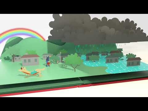
We’ve prepared a draft Hewitts Creek Floodplain Risk Management Study and Plan, which focuses on parts of Bulli and Thirroul. This study and plan looks at how flooding affects people, homes, infrastructure like roads and stormwater pipes, and public spaces likes parks and recreation areas. It identifies flood risks and looks at what we can do to reduce and manage those risks.
The study area covers several local waterways, including Slacky Creek, Tramway Creek, Woodlands Creek, Hewitts Creek, and Thomas Gibson Creek.
Overview of the study and plan
The draft Hewitts Creek Floodplain Risk Management Study and Plan outlines the potential risks and impacts of floods and recommends practical ways to reduce current and future flood risks. These findings will help us to guide future planning and development in this area.
As part of this study, we’ve identified several options (or measures) to help in managing flood risk in Bulli and Thirroul. These include:
Flood Modification Measures
These are built structures that help to control floodwater and reduce impact on public and private assets. They can also help our drains and culverts to keep free from blockage during big storms. Examples include levees, detention basins, and debris control measures.
Response Modification Measures
These help our community better prepare for and respond to floods by improving awareness and communication. Examples include emergency plans, flood warnings, and community education.
Property Modification Measures
These involve change/addition of flood planning controls for future developments (buildings, roads and others) to ensure that land uses are compatible with flood risk. It can also include voluntary house raising and purchase, or flood-proofing of buildings, which can reduce flood damages.
You can learn more about this Study and Plan by
- Reading the draft Floodplain Risk Management Study and Plan
- Looking at the map with the proposed Flood Mitigation Measures (more information on these are available on page 84 of the Study and Plan)
- Looking at the flood maps
- Reading about the proposed Response Modification and Property Modification Measures
- Reading the FAQs
You can visit Wollongong or Thirroul libraries to view printed copies of all the material.
We've also got lots of information and resources on things like creek maintenance, stormwater maintenance and flooding information. Look at the Important Links to find out more. You can also watch some short videos about flooding in Wollongong.
Share your thoughts by:
- Completing the online feedback form
- Emailing engagement@wollongong.nsw.gov.au
- Writing to The Engagement Team, Wollongong City Council, Locked Bag 8821 WOLLONGONG DC NSW 2500
- Phoning 4227 7111
You can also drop into our Let's Talk Thirroul session on Friday 29 August anytime between 3:30-5:30pm. No bookings necessary.
Feedback is open from 25 August to 26 September 2025.
Your input will help shape the final plan and guide future flood management in your community.
Please note, any submissions become public documents and may be viewed by other persons on request. Please read Council's Privacy Policy before submitting your feedback.
Accessibility and language assistance
If you’re d/Deaf, hard of hearing or have a speech or language difficulty, you can contact us through the National Relay Service. If you need an interpreter, you can contact us through the Translating and Interpreting Service on 131 450. You’ll need to provide our phone number 02 4227 7111 for either service.
-
Engagement Summary
Share Engagement Summary on Facebook Share Engagement Summary on Twitter Share Engagement Summary on Linkedin Email Engagement Summary linkConsultation has concludedThank you to everyone who participated in the Hewitts Creek Floodplain Risk Management Study and Plan engagement.
Council has heard from the community over several years to inform and develop the Hewitts Creek Flood Risk Management Study and Plan. This includes through targeted consultation during the Hewitts Creek Flood Study in 2019 and the Let’s Chat Thirroul session in 2024, inviting feedback and discussion on flood impacts. Ongoing and continuous engagement occurs through existing data collection such as collecting customer feedback, liaising directly with residents, reviewing technical and community-sourced flood data.
This year, we invited the community to share their thoughts on the flood mitigation measures identified as part of the Study and Plan. The feedback we received will allow Council to better understand specific areas of concern for this community and support the progression and prioritisation of flood mitigation works for this catchment area.
Engagement Participation Numbers
Between 25 August and 26 September 2025
 273 visits to the online engagement page
 9 surveys completed
 2 letters
 2 phone calls
 9 emails
 40 face to face conversations
This is a high-level summary of the feedback
- Most submissions were from residents or property owners within the Hewitts Creek catchment, reflecting strong local interest and concern.
- Several community members expressed appreciation for the Floodplain Risk Management Study and Plan, acknowledging the importance of progressing work to mitigate flood risks.
- There was support for some of the proposed flood modification measures, with suggestions offered to improve or reconsider certain aspects.
- Concerns were raised about Council’s historical response to flood risks, with some expressing a lack of confidence in Council’s management of this issue.
- A number of respondents were worried about the potential impact on property values and insurance premiums due to being identified within a Flood Risk Precinct.
- Specific locations—including creek lines such as Hewitts, Slacky, Tramway, Woodlands, and Thomas Gibson, and various streets—were highlighted as areas of significant flood impact.
Specific feedback on proposed medication measures was also received
- There was strong support for the Woodland Creek Levee, with suggestions to extend it across the culvert to the rail embankment, ensure diverted water doesn’t flow into Thomas Gibson Creek, and explore using the nearby safety ramp as a debris control structure.
- The additional culvert at Cliff Parade was widely supported, considered an effective improvement. A suggestion was made to reposition it to the lowest point of the street.
- The South Arm Diversion and Cliff Parade Culvert Upgrade also received support, with the latter seen as beneficial for managing flood impacts near properties.
- Vegetation management was supported, with calls for clearer maintenance schedules, prioritisation of overgrown areas like McCauley Street, clarification on land ownership responsibilities, and consideration of the community garden’s role in debris buildup.
- Other supported measures included property buy-back schemes, flood preparedness education, and community resilience initiatives.
Next steps
- All feedback heard from the community will now be considered by the project team and consultants. All responses will be reviewed in detail so that recommendations can be made for before finalising the Hewitts Creek Floodplain Risk Management Study and Plan.
- Feedback is important and is one factor of the decision-making process for Council. There are a whole range of things that are important in how we make a decision. The graphic above shows some of the factors we consider in our decision making:
- Keep an eye on the Our Wollongong page for project updates
Tell us how we did
We’d love to know what you thought about your experience when you engaged with us. Tell us how we did by completing this form.


Videos


Use the button below to report a drain or stormwater pit issue.
 Or you can call us on 4227 7111