Wollongong Coastal Management Program
Project Overview
We understand that our beaches and our coastal lifestyle are one of our greatest assets and are highly valued by our community.
We have approximately 60km of coastline, from the Royal National Park in the north to Lake Illawarra in the south. The character and functionality of Wollongong’s coastline is a blend of beaches, dunes, cliffs, headlands and rock platforms, and small coastal creeks and estuaries, and plays an integral part in the experience of the city for our residents and visitors to the Wollongong Local Government Area (LGA).
To ensure we can protect, enhance and effectively manage our coast and coastal assets, Council is preparing a Coastal Management Program (CMP), and you're invited to participate at key stages of the project.
Ultimately, the Wollongong CMP will identify coastal management issues and the actions required to address these issues in a strategic and integrated way.
Lake Illawarra is not part of this CMP for the coastal zone of the Wollongong LGA. Council has already developed a CMP for Lake Illawarra in partnership with Shellharbour City Council and the NSW Government.
The CMP project is supported with funding from the NSW Government’s Coastal and Estuary Management Program.
Stages of the Coastal Management Program
The preparation of the Wollongong Coastal Management Program involves five stages.
- Stage 1: Identify the scope of the CMP
- Stage 2: Determine risks, vulnerabilities, and opportunities
- Stage 3: Identify and evaluate options
- Stage 4: Prepare, exhibit, finalise, certify, and adopt the CMP
- Stage 5: Implement, monitor, evaluate and report

Further Information
You can learn more about the CMP by viewing the FAQs and project updates in the News Feed, or by contacting the project team.
If you're d/Deaf or have a hearing or speech impairment, you can contact us through the National Relay Service. If you need an interpreter you can contact us through the Translating and Interpreting Service on 131 450. You'll need to provide our phone number 02 4227 7111 when using these services.
Please read Council's Privacy Policy before submitting your feedback.
-
Project update - Coastal Hazards Study Underway
Share Project update - Coastal Hazards Study Underway on Facebook Share Project update - Coastal Hazards Study Underway on Twitter Share Project update - Coastal Hazards Study Underway on Linkedin Email Project update - Coastal Hazards Study Underway link
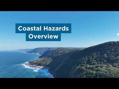
Residents may spot extra activity along the foreshore during September and October as Wollongong City Council begins fieldwork for a Coastal Hazards Study.
Specialist consultants have been engaged to identify coastal hazards—including cliff and slope instability, estuary and foreshore erosion, creek entrance instability, tidal and coastal inundation, and beach erosion and shoreline recession—as they are presently, as well as 20, 50 and 100 years in the future. Field work includes geotechnical and geophysical investigations and flying drones along our coast and estuaries to capture vital information.
The coastal hazard study forms part of Stage 2 of the process which involves technical studies to gain a better understanding of coastal issues and assessing the current and future risk to coastal values and assets. The remaining stages will identify and evaluate options to manage coastal issues and risks, compile the final agreed actions into a management program and then begin to implement it.
This video outlines the types of coastal hazards being investigated as part of the Coastal Hazards Study.
-
Project update - Stage 2 underway
Share Project update - Stage 2 underway on Facebook Share Project update - Stage 2 underway on Twitter Share Project update - Stage 2 underway on Linkedin Email Project update - Stage 2 underway link Council has been successful in attracting funding from the NSW Government’s Coastal and Estuary Management Program for the following projects:
- Identification and Vulnerability Assessment of Aboriginal Cultural Values and Assets
- Coastal Wetland and Littoral Rainforest Mapping
- Coastal Hazard Studies
Read more about these here.
These projects will be undertaken during 2024 and 2025 and will help to fill data gaps and update our knowledge of contemporary issues.
Funding has also been awarded to subsequently prepare the CMP. We will be sharing the results of the Stage 2 projects with our community in late 2025 so we can collaborate on the best management options to be included in the CMP.
-
Project Update – Stage 1 Scoping Study is Complete
Share Project Update – Stage 1 Scoping Study is Complete on Facebook Share Project Update – Stage 1 Scoping Study is Complete on Twitter Share Project Update – Stage 1 Scoping Study is Complete on Linkedin Email Project Update – Stage 1 Scoping Study is Complete link
We have now completed the Scoping Study, which is Stage 1 of the process to develop the Wollongong Coastal Management Program (CMP).
The Scoping Study utilises existing strategies, plans, reports, studies and data to identify past, current and future issues in the coastal zone. It reviews the management actions previously undertaken, and gains a contemporary understanding of management, through engagement with the community and stakeholders. The Scoping Study also identifies any knowledge gaps and provides a focus for the remaining stages required to develop a Wollongong CMP.
The Scoping Study was endorsed by Council on 20 March 2023.
Work will now commence on Stage 2 of the CMP process, which will see us complete a range of studies to obtain new data and update our knowledge base before the Wollongong CMP can be prepared.
View the Scoping Study in full
View the Scoping Study Summary -
Project Update - Stage 1 Scoping Study
Share Project Update - Stage 1 Scoping Study on Facebook Share Project Update - Stage 1 Scoping Study on Twitter Share Project Update - Stage 1 Scoping Study on Linkedin Email Project Update - Stage 1 Scoping Study link
We are currently in Stage 1, scoping the Coastal Management Program for the open coast and estuaries of the Wollongong LGA.
It is the first of the five-stage CMP process and it will result in a Scoping Study document. An objective of the scoping study is to understand what our community values about our coast and current and future issues in coastal areas. This will help us develop a shared understanding of the current state of the coastal zone and identify issues and areas of focus for the new CMP.
Undertaking the scoping process in Stage 1 is beneficial for a number of reasons:
- It provides a review process to understand the progress made to date, in managing issues in our coastal areas.
- It enables us to come together as a community to understand the current challenges and opportunities for our coastal area.
- It saves time and resources, by clearly defining the necessary focus areas for the new CMP.
Community and stakeholder engagement for the Scoping Study has now closed. We are currently collating the findings of the engagement and relevant coastal data and reports to prepare the Scoping Study. The Scoping Study will be published on this page when complete.
Documents
-
 Social and Environmental Risk Assessment May 2026 (23.3 MB) (pdf)
-
 Coastal Hazards Study
-
Coastal And Estuary Processes Study - Final 10 November 2025 (6.23 MB) (pdf)
-
Coastal Cliff Instability Study - Final March 2025 (36.8 MB) (pdf)
-
Coastal Entrances and Foreshore Erosion Study - Final October 2025 (36 MB) (pdf)
-
Inundation Beach Erosion and Recession Study - Final November 2025 (69.9 MB) (pdf)
-
Coastal Hazard Risk Assessment - Final March 2026 (93.7 MB) (pdf)
-
-
Scoping Study - Wollongong Coastal Management Program_ March 2023 (49.5 MB) (pdf)