Draft Neighbourhood Plan - Shone Avenue and West Dapto Road, Horsley
Share Draft Neighbourhood Plan - Shone Avenue and West Dapto Road, Horsley on Facebook
Share Draft Neighbourhood Plan - Shone Avenue and West Dapto Road, Horsley on Twitter
Share Draft Neighbourhood Plan - Shone Avenue and West Dapto Road, Horsley on Linkedin
Email Draft Neighbourhood Plan - Shone Avenue and West Dapto Road, Horsley link
Consultation has concluded
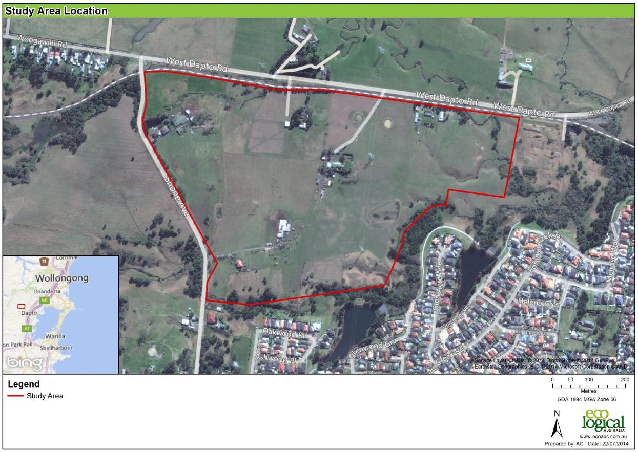
A Neighbourhood Plan is the step between the West Dapto Masterplan and a Development Application. A draft Neighbourhood Plan has been submitted for land bound by West Dapto Road to the north, Shone Avenue to the west and existing residential development in the suburb of Horsley to the south.
Summary of Draft Plan
The draft Neighbourhood Plan for Shone Ave and West Dapto Road, Horsley, provides for:
- approximately 393 low-density residential lots, ranging in size between 450m2 and 850m2
- one (1) lot measuring 1,588m2 for medium density residential development
- a sound wall (acoustic barrier) along the Wongawilli Colliery rail line, north of the study area
- a road layout with a heirarchy based on predicted traffic volumes
- recreation facilities including a playing field and environmental/open space land
- stormwater detention basins to manage flooding.
You'll find the draft Plan and supporting documents on the right of this page in the 'Document Library'. Please note the current draft neighbourhood plan is listed first and labelled 'Revised'. The draft plan was revised in response to issues raised by Council during preliminary assessment. The original neighbourhood plan is supplied for comparison and is labelled 'Superseded'. For more information on the draft plan and the assessment process so far, please refer to the Council report dated 23 February 2015.
Making a submission
Comments on the plan will be accepted between 20 April 2015 and 22 May 2015.
To provide feedback, complete the online form below, email records@wollongong.nsw.gov.au or write to:
The General Manager
Wollongong City Council
Locked Bag 8820
WOLLONGONG DC NSW 2500
before 22 May 2015. Please quote the reference number ESP-100.02.019 in your submission.
Please read Council’s Privacy Notification before making your submission.
For more information, visit the 'Frequently Asked Questions' section of this webpage or call Council on (02) 4227 7111.
Signup Banner