
Minnegang Creek Catchment Flood Study
Consultation has concluded
As part of our commitment to managing flood and stormwater in our region, we’re working on a flood study for the Minnegang Creek catchment. This Study explains the ways flooding happens in the Minnegang Creek catchment, in the Lake Heights area.
We’ll be sharing the report with the community during the public exhibition from 26 August to 23 September 2019. Come along to our drop-in community information session where the floodplain engineers working on the Study will be available to answer your questions. There’s no formal presentation as such. Instead, we’ll have the report available for viewing, display stands showing flood mitigation projects, flood modelling maps and a short flood modelling video to help explain how and where it can flood in this catchment. This is a drop-in session, so you can come in at any time.
When: Saturday 7 September 2019, drop in anytime between 12:30pm – 2:00pm
Where: Warrawong Community Centre, 7-9 Greene Street, Warrawong
If you’d like to attend and have accessibility or mobility requirements, or need an interpreter, please contact us to let us know how we can support your attendance.
If you’d like to learn more but are unable to attend a session, the Report will also be available to view at Warrawong Library until Monday 23 September, with copies of the FAQ, feedback forms and reply-paid envelopes available for people to take.
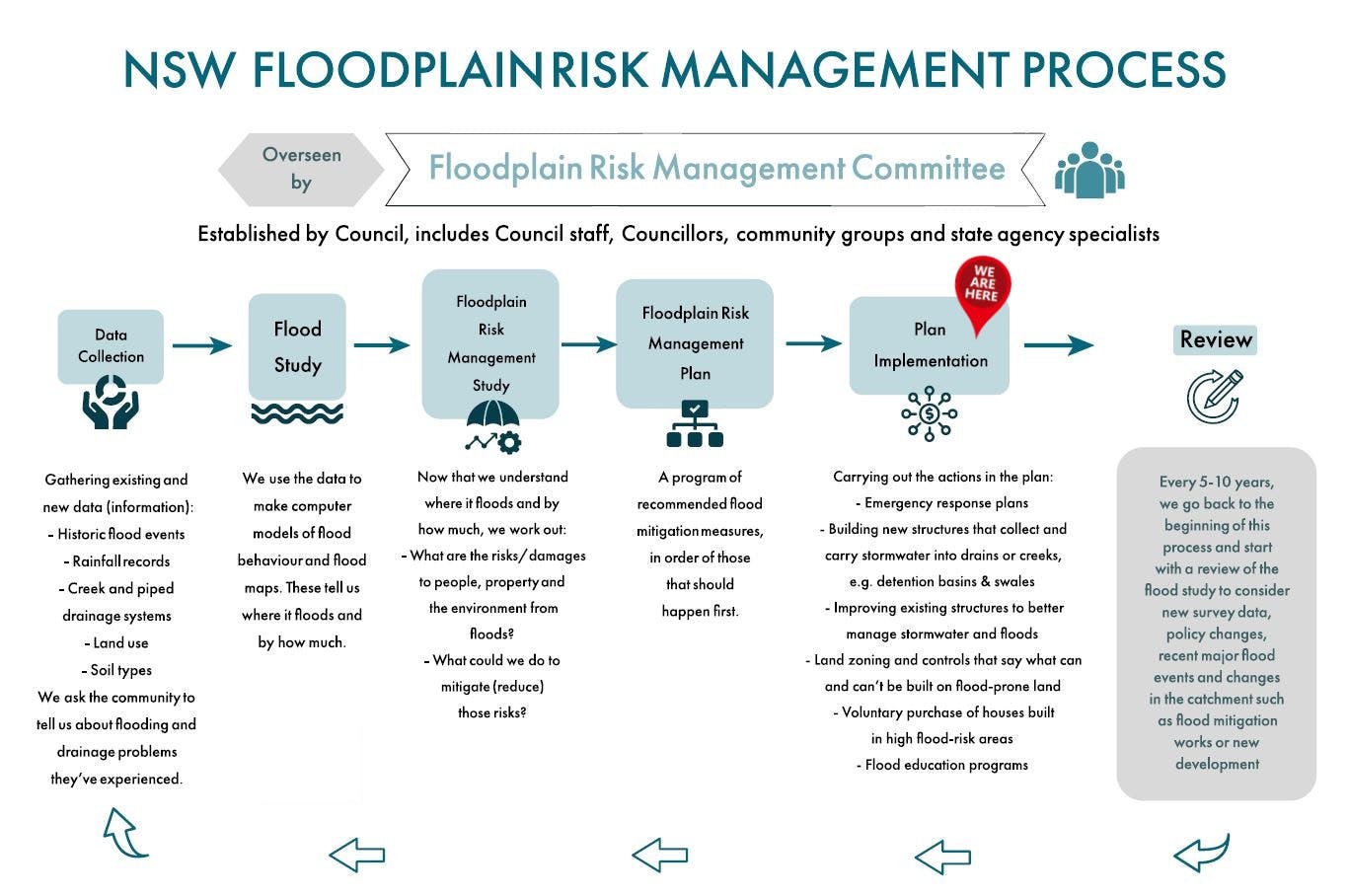
Read the FAQ, draft Report and have a look at the Floodplain Risk Management Process diagram to learn more about the Study, how we manage flood risk and what we will use the flood study information for, then share your feedback online with the project team.
Following our conversations with the community, the Minnegang Creek Flood Study will go to Council for adoption. After that, we can start working on a Floodplain Risk Management Study that looks at what the risks and damages from floods might be, and what we could do to mitigate (reduce) those risks. We’ll again be inviting the community to contribute to that process when the time comes.
Feedback closes on 23 September 2019.
Signup Banner


Photos
Flood Modelling Video - click ⤢ for full screen
-
 This video shows a rare (1% Annual Exceedance Probability) flood event. There is a 1% chance of a flood of this size or larger occurring here in any given year.
