Wollongong and West Wollongong New Shared Paths
Consultation has concluded
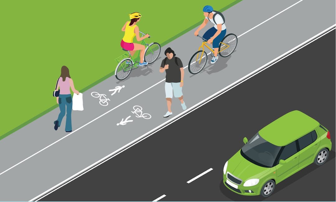
As part of our commitment to improve pedestrian and cyclist safety and amenity, Council is proposing new shared paths in Wollongong and West Wollongong. Identified in Council’s Cycling Strategy 2030, the proposed paths will form vital links from West Wollongong to Wollongong’s foreshore. Plans have been developed and we’re now seeking feedback from the community.
Reserve Street and Gilmore Street New Shared Path
Check out the draft plans here
The shared path will make it safer for people to cross Reserve Street and Gilmore Street and make it more accessible for people to walk and ride to Gilmore Park and the tennis courts. This will also create a more complete link from Robson Road to Throsby Drive, and on to Flinders and Smith Street to the Harbour as a set of shared use paths and cycleways.
Bourke Street and Virginia Street New Shared Path
Check out the draft plans here for Bourke Street
Check out the draft plans here for Virginia Street
The draft Bourke Street and Virginia Street New Shared Path will make it easier and safer for walkers and riders to travel between North Wollongong Train Station, Stewart Park and North Wollongong beach.
For more information and to share your thoughts on the Wollongong and West Wollongong New Shared Paths
You can find out more by reading the FAQs and viewing the plans. To make comment, you can:
- Completing the online survey
- Emailing engagement@wollongong.nsw.gov.au
- Phoning (02) 4227 7111
- Writing to The Engagement Team, Wollongong City Council, Locked Bag 8821 WOLLONGONG DC NSW 2500
Accessibility, mobility or language assistance
If you’re d/Deaf, hard of hearing or have a speech or language difficulty, you can contact us through the National Relay Service. If you need an interpreter, you can contact us through the Translating and Interpreting Service on 131 450. You’ll need to provide our phone number 02 4227 7111 for either service. If you would like to attend the information sessions and have accessibility or mobility requirements, please let us know how we can support your attendance. We can also arrange for an interpreter to come along to help residents who have difficulty communicating in English. To arrange support, please contact engagement@wollongong.nsw.gov.au
Join the conversation
Share your feedback with the project team by 8 November 2023. Submissions become public documents and may be viewed by other persons on request. Please read Council's Privacy Policy before submitting your feedback.
-
Update - North Wollongong Shared Paths Project Summary
Share Update - North Wollongong Shared Paths Project Summary on Facebook Share Update - North Wollongong Shared Paths Project Summary on Twitter Share Update - North Wollongong Shared Paths Project Summary on Linkedin Email Update - North Wollongong Shared Paths Project Summary link
Here’s a summary of what we heard and how it was considered in the project proposing Shared Pathways in Virginia Street and Bourke Street.
Safety
Feedback about the impact the plan would have on safety was mixed. Safety concerns focussed on the interaction between users of the path and increased blind spots for drivers.
How your feedback was used
We note the designs proposed are for shared paths along all these routes to cater for both pedestrians and cyclists (of all levels) and we consider this proposal suitable in striking the balance for mixed-use for all users to share. By law bicycles are considered a vehicle in NSW and are eligible to ride on the road and we still expect this behaviour to occur by advanced riders.
We’ve amended the plan to include additional advisory line marking along the driveways to warn vehicle users on their obligation to give way to cyclists at driveway crossing points in line with current best practice.
Flooding
Several residents raised concerns about flooding. Council was asked to investigate the potential impact the proposed path has on water overflow in Virginia Street. It was suggested the Bourke Street shared path would be better on the north side as it is in urgent need of upgrading the undersized drainage infrastructure for flooding and pedestrian safety need and to reprofile the verge and crossovers to contain as much flood water within the Council’s Road reserve as possible.
How your feedback was used
Council considers the impacts of flooding as part of all new infrastructure projects. Council are currently reviewing the feasibility of delivering the shared path on the north of Bourke Street and will re-engage in the future with the outcome.
Environment
Some members of the community were concerned about the reduction in shade and greenery when established trees were removed for the shared path. The reduction in shade and greenery was mentioned in several submissions with a request to plant more trees, using local native species. Several people commented on the addition of black oxide coloured concrete for the path and its effect on urban heat.
How your feedback was used
Council, where practically possible, endeavour to introduce new street trees at every opportunity when constructing new footpaths and shared paths in the LGA. For this project the presence of underground communication and electrical services and limited verge width have prevented the introduction of new street trees on the western side of Virginia St.
Black oxide coloured concrete has been proposed in this location in accordance with councils adopted Public Domain Technical Manual as Virginia St is identified as a Mixed Use/ Residential Street in the hierarchy map.
Traffic, Parking, Speeding
Some members of the community were concerned about the high volume and speed of traffic in Bourke and Virginia streets and highlighted options for traffic calming measures like raised crossings, roundabouts or narrower intersections. Alternatively, several submissions thought providing active transport links in the area would reduce traffic.
How your feedback was used
We’ve amended the plan following further investigation and a review of community feedback.
The proposed Shared Path on Virginia Street will form part of a broader network of cycling links planned for Wollongong. This network also includes a Shared Path on Bourke Street which establishes the east-west link from North Wollongong Station to the Foreshore – this is programmed on our Infrastructure Delivery Program to be completed in two stages. The expanded Shared Path network will provide increased opportunities for the community to safely and sustainably access these areas and reduce the reliance on private vehicles, and in doing so, reducing congestion.
Additionally, it is noted that the Bourke Street / Virginia Street and Bourke Street / Keira Street intersections were upgraded to signalised controlled to improve safety and traffic calming by Transport for NSW.
Signage
There were mixed views on moving the no stopping signs. There were various suggestions for improving signage including:
- incorporating cyclists in the traffic signal lanterns,
- adding wayfinding signs to the area,
- adding solid yellow lines on either side of the George Hanley Drive crossing blister,
- increasing the size and number of instructional signs (rules) on the shared paths to improve safety for users,
- line marking to be continuously featured along the path.
How your feedback was used
The final design plans will incorporate cycling wayfinding signage in accordance with regulatory guidelines and consistent with examples across our LGA. Regulatory signage and line marking such as the yellow lines as well as separated line marking along the shared path is incorporated in the final detailed design.
What’s Next
The feedback we received from the community has been used to make changes were possible. We’ll notify the community about the construction of the new shared path prior to any works commencing. At this stage we believe that will be in the first half of 2025.
Stay in the loop
For updates visit the Works and Project page or sign up for Council’s e-news.

Who's Listening
-
Engagement Officer